Spring 2014 – Frequently Asked Questions by Dr. Chuck Wilson
– June 10, 2014
(From Spring 2014 Newsletter) Dr. Chuck Wilson, Chief Scientific Officer for the Gulf of Mexico Research Initiative (GoMRI), answers a few of the most frequently asked questions about the program.
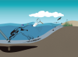
Question: Why is numerical modeling important to GoMRI?
Answer: Numerical (computer) modeling is a powerful tool in the sciences that can be used to address many of society’s needs. For example, numerical models can be used to forecast the weather, hurricane direction, strength and impact at landfall, stock market trends, and even the likelihood of individual credit card risk. Following the Deepwater Horizon oil spill, models were used to predict the direction of released oil movement at the surface and under the water and understand how the oil/gas mixture would behave after entering the marine environment from the wellhead. NOAA and the Coast Guard are responsible for the maintenance of the operational ocean and atmospheric forecast models used in the event of an oil spill and they often incorporate high resolution Navy models. Many of the Consortia currently funded by GoMRI include modeling research components. The overarching goal for all of these modeling efforts is to better forecast how oil will behave following an accidental release. GoMRI scientists are improving modeling efforts on all scales and these results will have application across a number of different disciplines.
Question: What kind of modeling work is being done through GoMRI?
Answer: Micro-scale modeling can predict how small oil droplets will behave in the presence and absence of dispersants and at different pressure and temperature. Important modeling parameters at the micro-scale level involve shear forces (friction between the oil droplet and surrounding water molecules), buoyancy and density, which affect turbulent motions. C-Meds and DROPPS are involved in micro-scale modeling.
Sub-mesoscale modeling can predict how small scale structures (eddies, filaments) form at the ocean surface or in the deep near a wellhead. As the warmer, more buoyant oil rises to the surface, it mixes with the surrounding water and its motion is influenced by larger scale currents driven by density differences. The mixing efficiency will depend on the amount of dispersant present in the water column. C-IMAGE, CARTHE, DEEP-C, and GISR are involved in modeling sub-mesoscale processes to help scientists estimate how fast the oil gets to the surface, the size of the oil droplets and how mid-water depth plumes form, move, and dissipate.
Mesoscale and basin-scale modeling can predict chemical and biological transport at the surface and at depth across large bodies of water (bays, lakes, and oceans). Important parameters involved in large scale modeling research include rotation and driving forces such as atmospheric fields (winds, temperature, pressure, and precipitation), solar radiation, and tides. Modeling accuracy at these scales relies on the ability of the models to represent the above-mentioned sub-mesoscale processes. Gulf of Mexico-specific models such as NCOM and HYCOM are standard oceanographic models used to predict water movement in the Gulf of Mexico. These models were used during the Deepwater Horizon oil spill to predict the direction that oil would flow once it reached the surface, as well as where mid-depth plumes might have gone. DEEP-C, CARTHE, CWC, and GISR are involved in mesoscale and basin-scale modeling research.
Ecosystem modeling can predict how physicochemical and biological elements in an ecosystem interact and impact one another. Several GoMRI Consortia conduct ecosystem modeling to determine how an oil spill might affect things such as fish behavior or marsh grass recovery times. Ecosystem models tend to be extremely complex, integrating both physical and biological research results across spatial and temporal scales. C-IMAGE, DEEP-C, and CWC are involved in ecosystem modeling.
Question: How does modeling research help?
Answer: The ultimate goal for modeling research is to help scientists and the public better understand and predict how man and nature interact with and affect an ecosystem. In the event of another oil spill, or other anthropogenic or natural event, improvements of models on all scales and their integration into ecosystem models will enable scientists