Summer 2016 – Guest Frequently Asked Questions with Dave Westerholm
– JULY 29, 2016
(From Summer 2016 Newsletter) GoMRI is pleased to have Dave Westerholm, Director of NOAA’s Office of Response and Restoration, answering a few Frequently Asked Questions (FAQs) about NOAA’s role in oil spill response and how the science community can be involved in the response process. Mr. Westerholm was a Captain (ret.) in the United States Coast Guard and is Chair of the Executive Committee for the Gulf of Mexico Oil Spill and Ecosystem Science conference. We thank him for taking the time to answer a few questions about this important topic!
As Director of NOAA’s Office of Response and Restoration, I’ve been asked to give my perspective on three questions some of you may have been wondering about.
Question: What is NOAA’s role in the oil spill response process?
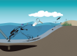
Answer: Under both the Oil Pollution Act of 1990 and the Clean Water Act, NOAA brings several regulatory roles, as well as additional scientific expertise, to an oil spill response. We maintain a response posture that allows our Scientific Support Coordinators to answer questions related to the science of oil spills — ranging from chemistry and biology to oceanography and meteorology — all tailored to help the U.S. Coast Guard and others in the Unified Command make informed decisions during a response. This key response advisory role draws on internal and external scientific and environmental expertise.
We also serve as the federal trustee for marine resources, including dolphins, salmon, and salt marshes. In this role, we assess the extent of any natural resource impacts from a spill and its response operations and work to ensure the appropriate type and amount of restoration takes place to make up for those damages. Our response and restoration work requires us to pull from the full bandwidth of NOAA expertise, which spans tides, currents, weather forecasts, and satellite imagery, as well as fisheries and protected species.
Question: In what format is scientific information most useful to the emergency response community?
Answer: During oil spills, NOAA works with information in a myriad of formats. We incorporate oceanographic, meteorological, and hydrographic data into various software tools we have developed that model the trajectory, fate, and behavior of oil. Before a spill happens, we collect biological, ecological, and archaeological data into maps showing coastal environmental sensitivity to oil. In addition, we have developed tools to help our scientists and others integrate and visualize environmental data into a single, shared map-based view during and after spills. This critical suite of tools enables our Scientific Support Coordinators to convey accurate information in a timely manner to a spill’s Federal On- Scene Coordinator, empowering the best possible decisions for the public and the environment.
Question: How does NOAA incorporate outside science during an oil spill?
Answer: When possible, NOAA’s oil spill scientists are eager to collaborate with other government, industry, and academic scientists in order to help us solve the complex problems presented in an emergency response setting. Such involvement is facilitated by relationships established and involvement in the planning process in advance of a spill. There have been multiple initiatives aimed at enhancing engagement with academic scientists during spill preparedness and response activities, which is important due to the lack of established funding available for pure research during an oil spill. At this point, however, there is no single model or approach to fostering these relationships, but, as various models are considered, we hope to see the involvement of academic scientists continue to scale up.
At the same time, NOAA has a long history of working with academics as we evaluate potential environmental harm during the NRDA (Natural Resource Damage Assessment) process that follows an oil spill. When working on larger or possibly contentious cases, we reach out to experts for help quantifying impacts to natural resources and the services they provide the public. This typically involves doing fieldwork to measure whether adverse changes have occurred to natural resources and services.
The scientists we work with in these cases depends on the location of the spill and the potentially impacted natural resources and services we are trying to measure. While we do work with academics that have previously collaborated with us, we also seek out those with particular expertise in the natural areas and marine resources commonly affected by pollution and we’re always looking to identify new experts. Outside of spill scenarios, we also invite experts to help us develop scientific techniques and methods for future NRDAs.
As part of the 2017 Gulf of Mexico Oil Spill and Ecosystem Science Conference, we hope to discuss this topic in more depth and explore how some of the oil spill science that has been done over the last few years might influence policy, response decisions, and natural resource damage assessment.