Summertime & Fall Fieldwork
– NOVEMBER 28, 2016
(From Fall 2016 Newsletter) To highlight the summer and fall research seasons, we asked the GoMRI-funded consortia to tell us what they’ve been working on by asking them three questions:
- What did your consortia do during the summer and fall field seasons?
- What was one of the most exciting or interesting things that happened?
- What do you hope to discover or learn as a result of this field work?
C-IMAGE
Provided by Ben Prueitt, C-IMAGE Program Manager
Aboard the R/V Weatherbird II, researchers with the C-IMAGE-II Consortium planned the One Gulf Expedition, which collected thousands of bottom- dwelling fish, sediment, water, and plankton samples from the Yucatan Peninsula and Bay of Campeche to the Texas shelf. The 4,000 mile journey circumnavigating the Gulf completed a four-year plan to establish fish samples and sediment cores of baseline data from across the Gulf in Mexican and U.S. waters. While the R/V Weatherbird II was circling the Gulf, the Tunnell Trek was collecting tar, sediment cores, and tree cores from Mexican coastlines impacted by the 1979 Ixtoc I spill.
Surprisingly, C-IMAGE researchers found buried oil and tar in mangrove forests, rocky shorelines, and beaches of Mexico’s Campeche, Tabasco, and Veracruz shorelines – evidence of residual oil. We assume this oil is 37-year-old tar from the Gulf’s second largest spill, Ixtoc I. Some of these tar balls still gave off oil sheens in tide pools along the coast. The samples collected will provide insights to the decade-long degradation of oil and tar on shorelines and how the northern Gulf might look in 30 years from the Deepwater Horizon spill.
C-IMAGE conducted regular fishing and ROV surveys on fish populations off the Texas, Mississippi, and Florida coastlines. These studies compare the effectiveness of artificial reefs and oil rigs to recruit native reef fish but also the impact of invasive lionfish on reef ecosystems.
DEEPEND
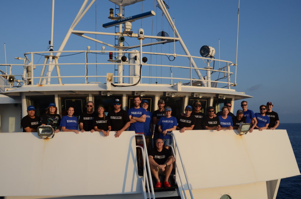 DEEPEND researchers on the R/V Blazing Seven. Photo Credit: DEEPEND. |
Provided by Heather Judkins, DEEPEND Education and Outreach Coordinator
This summer, DEEPEND continued their multi- vessel surveys of the deep Gulf of Mexico. The main focus of DEEPEND’s summer field operations was to continue our time-series analyses of deep-pelagic nekton (fishes, crustaceans, and cephalopods) and oceanic larval fishes (with emphasis on tunas and billfishes). Specific areas of research included deep-pelagic community structure, abundance, distribution, behavior, and biochemical composition. Of special interest during this summer’s field season was the discrimination of the types of pelagic habitats of the oceanic Gulf of Mexico, including the loop current and its large eddies, mesoscale eddies, offshore riverine water, and “common water.” Four cruises were conducted, two aboard the R/V Point Sur and two aboard the R/V Blazing Seven. During Point Sur cruises, a net system was used to sample nekton from the surface to 1500 meters, with concurrent hydroacoustic sensing. These samples will be used to quantitatively assess the assemblages and to provide material for lab- based studies (genetics, biochemistry, organismal biology). The Blazing Seven cruises sampled two transects from the surface to 100 meters using ichthyoplankton nets. All cruises were updated in real-time on the DEEPEND site, with daily blogs and images. Among the more exciting findings were: a new (undescribed) species of fish and possible new jellyfish; PAH levels in fishes are back to their pre-spill values, but the composition is that of degraded oil, differing from pre-spill composition; PAH levels in fish eggs is three times that of their parents; and larval tuna numbers were higher in offshore filaments of the Mississippi River than in common water. Our acoustical data provided unprecedented evidence that global vertical movements of mesopelagic scattering layers are controlled by fine-scale behavioral mechanisms. Probably the most significant finding, however, was corroborative evidence that the abundance of deep-pelagic nekton has decreased substantially in the last couple of years (2015-2016). This pattern was not obvious immediately after the spill (2010- 2011). The DEEPEND team is currently investigating these findings in great detail. In addition to field work, education and outreach was active this summer, including teacher- at-sea participation on research cruises, Creep into the DEEPEND virtual classroom missions, the release of a new learning module (“Pollution”), and new DEEPEND exhibits at the San Antonio Zoo and the Oregon Coast Aquarium.
ACER
Provided by Tina Miller-Way, ACER Education and Outreach Coordinator
ACER is investigating the link between biodiversity and ecological resilience in the coastal areas affected by the oil spill. Diversity is being explored at several scales – genetic, functional, and taxonomic – and in many organismal groups from microbes to sharks. ACER is divided into seven research groups based on this focus.
The wetlands group finished their almost year-long mesocosm experiment looking at the interaction of plant taxonomic and genetic diversity with plant responses to oiling. The microbes group sampled the algal mats that unexpectedly developed in the mesocosms. The microbe group is now looking at the thousands of sequences they have in hand from last year’s sampling. Preliminary data show differences in the genomic diversity between prokaryotes (16S) and eukaryotes (18S), with the latter group showing greater diversity. Field sampling by the oyster group extended from Florida to Louisiana, and they have begun their mesocosm experiments dosing oysters with oil, dispersant, and a combination of the two. They have concluded that oysters are pretty hardy but that it is possible to cause significant mortality with an oil and dispersant mixture. The consumer group has continued their sampling cruises, and their predator-prey mesocosm experiments are continuing. These will likely be finished by the end of the year. The nitrogen cycling group feels that they were able to get a good handle on the seasonal variation in denitrification rates in year one and are now examining the spatial variation among the habitats and sites in the Chandeleurs. The infaunal group has completed sample analysis for diversity and abundance at the Chandeleurs and Tampa Bay sites and have started collection of biomass data that might be important as they interpret rates of bioturbation. The microzooplankton group has some interesting results from their incubation experiments, which have led them to pursue some investigations on transparent exoploymers. They have also submitted a number of algal clones to the National Center for Marine Algae and Microbiota (NCMA), so the Gulf of Mexico presence is increasing there!
Some interesting results have been noted from sites in the Chandeleur Islands (ACER’s primary study area). Sampling in 2015 revealed a layer of highly contaminated sediment 15-20 centimeters below the surface in both marsh and seagrass (Ruppia) communities. Microbes associated with oil biodegradation were present at the sites, but the microbial community was not significantly different from other sites or habitats. While the wetlands group noted no significant differences in the macrofauna diversity or abundance at these sites compared to other sites, preliminary data from the infaunal group showed a significant loss of infaunal species diversity and reduced abundances at sites in the region of the buried oil. Interestingly, sampling at these sites in 2016, following several mild storm events, clearly showed mats of oil two to three inches thick on the sediment surface spanning a wide area. The potential resuspension of oil from deep in the sediment can lead to additional oil exposure after storms over time and perhaps repeatedly reset the temporal trajectory of recovery.
ACER is investigating the link between biodiversity and ecological resilience in the coastal areas affected by the oil spill. The key hypothesis they are testing is whether more diverse ecosystems are more resilient. Given the variety of data ACER is generating with respect to organismal groups and type of diversity, the ACER project will contribute substantially to the robustness of the answer to this question. The answer to this question has profound implications for management of our coastal zones.
CWC
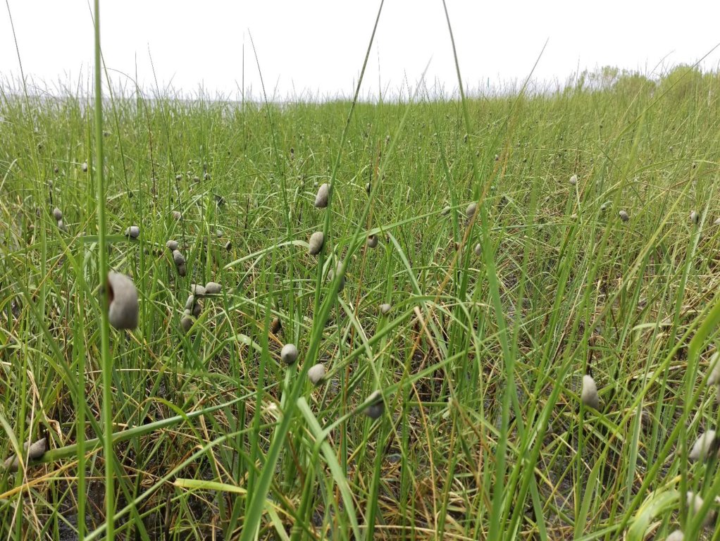 Salt marsh periwinkle snails on Spartina alterniflora. Photo Credit: CWC. |
Provided by Murt Conover, CWC Associate Director of Education and Outreach
The Coastal Waters Consortium-II (CWC-II) has had another busy field season conducting research in wetlands of coastal Louisiana with a goal of better understanding the fate and continued degradation of oil, its influence on food web structure, and how the resulting shifts influence populations, individuals, and ecosystem functions during the recovery phase as well as how continued oiling impacts interact with other ecosystem stressors. CWC-II’s research activities in 2016 have involved both the continuation of many established field and laboratory activities examining recovery trajectories and the exploration of new ideas and approaches into continued and expanded research areas. The 2016 field season kicked off early, with insect collections beginning in January and extending throughout the year, loons in February through March, and seaside sparrow and marsh rice rat abundance counts in March-June. Some sampling efforts involve year-round field collections and incubations/ experiments including plant dynamics and biogeochemical processes, while many others are focused during CWC’s “marsh madness” sampling campaigns that take place in May and October of each year, bringing together researchers from across CWC-II in a coordinated effort to examine marsh conditions and communities at unoiled and oiled sites across three regions of the Louisiana coast.
CWC-II researchers have employed several new or expanded approaches in 2016. For example, the Seaside Sparrow group began trial deployments of video monitoring systems at 10 nests to shed light on the main causes of nest failure and gain new insights into what the predominant nest predators might be, with the ultimate hope of expanding this effort to an increased number of nests in order to capture as many predation and/or failure events as possible. In effort to better understand the fate and continued degradation of oil, CWC-II researchers began testing a handheld photoionization detector (PID) and non-invasive soil probe as a less destructive detection method of oil that might not be visible from the surface or detected in regular surface sediment samples (top 5 centimeters). This technique is still being optimized and validated for the vertical and horizontal subsurface distribution of oil along impacted coastal marshes, but preliminary results are promising. The CWC-II marsh food web effort continues to have its sampling efforts coordinated with the broader “marsh madness” sampling campaigns in May and October but was expanded in the 2016 field season to include sampling of biomarkers (bulk tissue carbon, nitrogen, and sulphur stable isotopes; compound-specific stable isotopes in amino acids; and fatty acid profiles) of food web components at two additional sites along a salinity gradient to better constrain how carbon flow through food webs is expected to change in response to anticipated shifts in salinity regimes. One important component of the food web, the marsh periwinkle, was the focus of several projects involving CWC-supported research experiences for undergraduates (REU) interns this summer. These projects included an examination of spatial distribution, density, biomass, morphometrics, and grazing pressure on them in marshes across the Louisiana coast and an examination of the foraging preferences of the marsh periwinkle. Additionally, CWC-II researchers have begun examining how shifts in marsh vegetation influence soil microbial communities and the rates of some key biogeochemical processes. It continues to become increasingly difficult to track the impacts of the oil spill in dynamic coastal landscapes impacted by a multitude of stressors. The construction of a large marsh mesocosm facility at LUMCON has been progressing throughout 2016 and is aimed at aiding CWC-II researchers to overcome some of these challenges by allowing us to initiate a large- scale marsh oiling experiment during the 2017 field season.
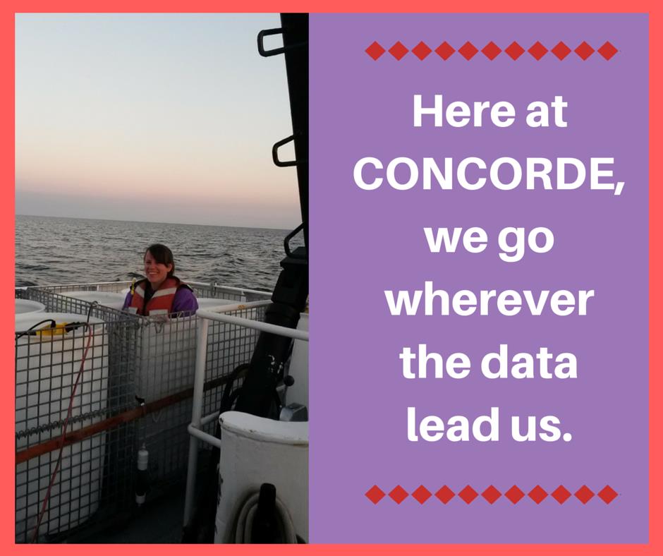
CONCORDE
 Postdoctoral researcher Hannah Box exemplifies a CONCORDE practice from inside a bin where she collects water to measure radium concentrations that will provide information about sources and movement of water bodies. Photo Credit: CONCORDE. |
Provided by Jessie Kastler, CONCORDE Outreach Coordinator
“When swapping at-sea stories with colleagues, we can all agree that who you share the boat with will easily make or break a research cruise. As a consortium project, there are 18 scientists representing four institutions on board the R/V Point Sur, all with different skill sets, levels of experience, and paths that brought them to the CONCORDE team. Remembering that the term “Concordia” is Latin for harmony, this project could not have been more appropriately named.”
So begins the final entry in CONCORDE’s informal blog, describing the research cruise undertaken July 23-31, 2016. The daily blog was a team effort of researchers Kelia Axler, Carla Culpepper, and Ali Deary to document life aboard the R/V Point Sur. Dr. Deary also provided a daily science update to share research progress. As with blogs written during other CONCORDE cruises, the summer campaign blog was read eagerly by families of those aboard. Facebook introduced the project to nearly 6,000 other people who clicked on one of 50 cruise posts. Popular posts showed images of “charismatic” planktonic organisms and graphics of water conditions. The cruise documented changes in plankton distributions associated with low dissolved oxygen, or hypoxia. Widespread hypoxia is stressful to organisms. The summer CONCORDE cruise documented distributions and types of plankton under these conditions to assist in predicting oil impacts during a spill. An adaptive sampling strategy guided the path of the Point Sur using onshore remote sensing interpretation.
Of course, what people really want to know is who’s out on the boat and what are they eating. Blog entries introduced both the accommodating vessel crew and the diversely trained research scientists, providing images of them in their natural ship-board habitats. Get glimpses of exquisitely prepared meals and snacks provided at all hours by the award winning chef of the Point Sur… bananas-foster king cake… yum.
LADC-GEMM
 LADC-GEMM consortium scientists and students on UL Lafayette campus during the 2016 annual meeting (September 28-29). Photo Credit: LADC-GEMM. |
Provided by Natalia Sidorovskaia, LADC-GEMM Consortium Director
In October 2015 the LADC-GEMM consortium recovered over 35 Terabytes of passive acoustic data collected by mobile and bottom-moored stationary autonomous platforms in the Northern Gulf of Mexico at the vicinity of the 2010 oil spill site. Data were collected during the summer and fall months of 2015. This dataset contains a wealth of information about the Gulf of Mexico and its inhabitants. LADC-GEMM scientists had a big task for 2016 to sort through these data using sophisticated computer algorithms to understand how the deep-diving whales have fared five years after the oil spill by comparison with data collected at the same sites in 2007 and 2010. It felt very much as a 007-agent eavesdropping on the deep-water world. Beaked whales, most elusive to visual observations and the extreme deep-water divers among marine mammals, endangered sperm whales, and many species of deep-water dolphins populate the area of the Mississippi canyon near the spill site. All of them rely on acoustic sounds to find food and communicate with each other in the deep ocean. Their auditory systems are far more superior than any sonar systems developed by humans. The abundance estimates, based on counting sounds produced by animals, have shown that the beaked whale presence in the area suffered a decrease from 2007 to 2010 but recovered from 2010 to 2015. Overall, the regional population density decreased by 35 percent from 2007 to 2010 and increased by over 300 percent from 2010 to 2015. It is likely that the beaked whales left the study area during and right after the spill because of decreased food availability caused by the spill. The good news is they are coming back. However, we still do not understand the long-term effects on their health and fecundity. Only continuous acoustic monitoring of the stock over several years can provide reliable answers. The advancement of the automatic computer algorithms allowed LADC-GEMM researchers not only to distinguish beaked whale echolocation clicks among other ocean sounds but also to separate different species of beaked whales. LADC- GEMM scientists are learning more about these mysterious Gulf animals by developing more sophisticated computer programs to process acoustic data. For example, Cuvier beaked whales dominate two deep water sites (over 1500 meters) while the Gervais prefer shallower waters of the continental shelf (approximately 1000 meters), perhaps explained by ecological niche model. The processing results also point to other factors, which impact day-to-day movements of these animals, such as industrial acoustic noise, weather conditions, fishing, etc. Researchers clearly see that the acoustic activity of beaked whales drops when there is an increased level of seismic exploration noise in the area. LADC-GEMM will continue monitoring the sites into the winter months of 2016 and through the summer and fall of 2017 to obtain more reliable information about the long-term oil spill impact. The analysis of data relevant to endangered sperm whales and dolphins is currently underway.