C-IMAGE at Sea: Monitoring Impacts and Mentoring Students for Long-Term Gulf Oil Studies
– June 12, 2012
 (Click to enlarge) Development engineers at the Scripps Institute of Oceanography (SIO) deploy a High-frequency Acoustic Recording Package (HARP) from the R/V Sproul. (Credit: SIO) |
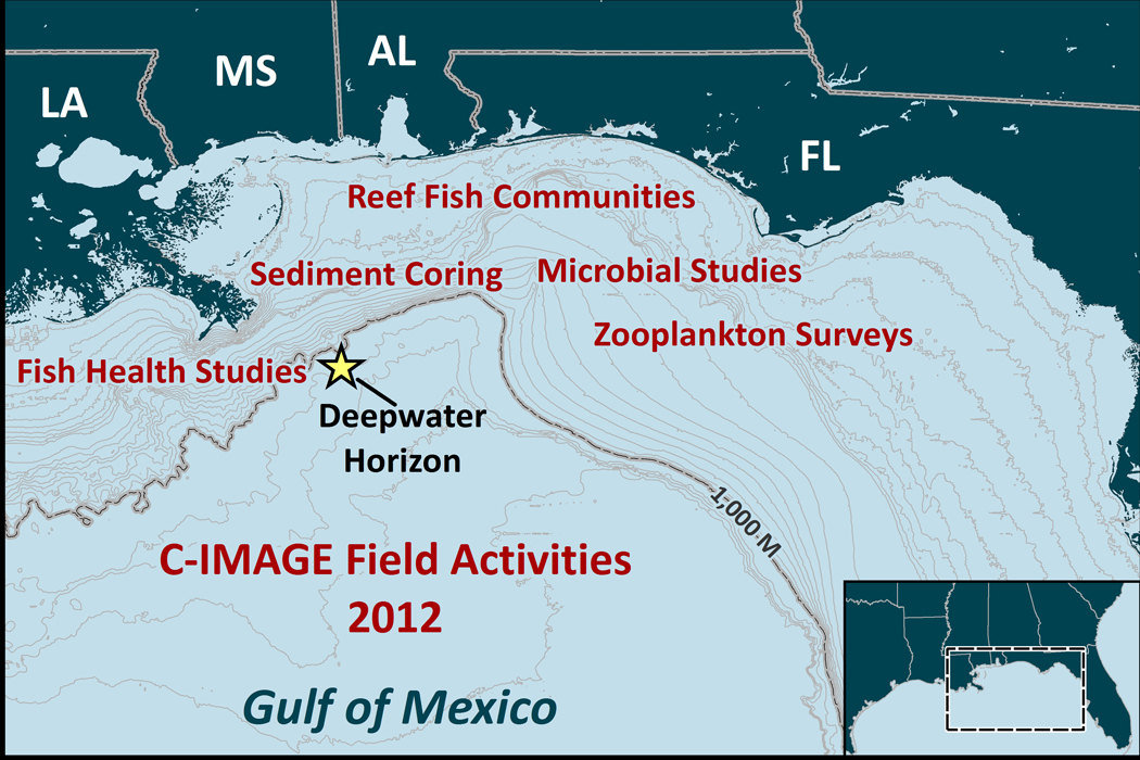 (Click to enlarge) Areas of focus in the Gulf of Mexico for C-IMAGE research. |
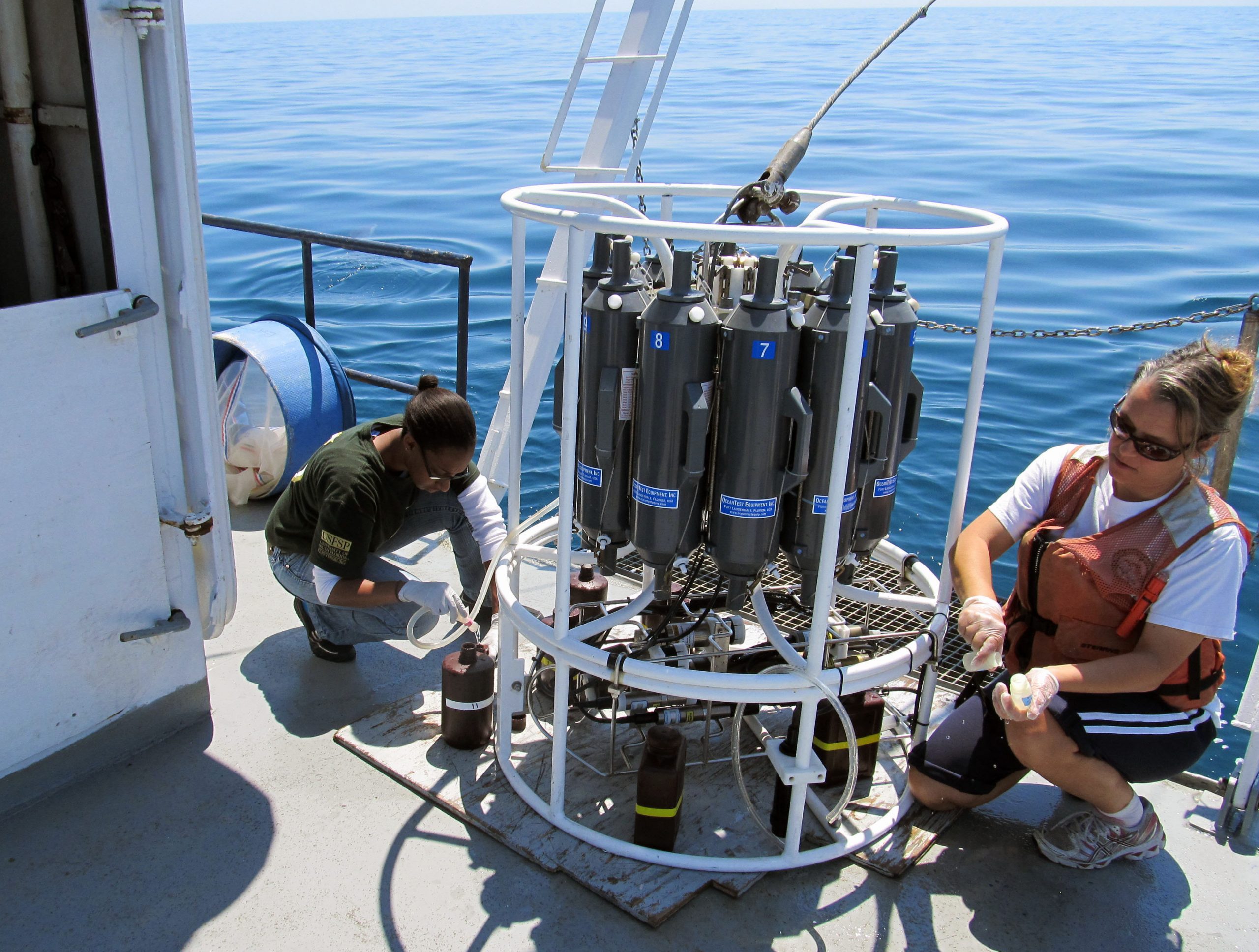 (Click to enlarge) On the R/V Bellows, Sue Murasko (Fish and Wildlife Research Institute) and Jonelle Baso (USF) collect discrete water depth samples from a CTD rosette for nutrient analysis, chlorophyll a measurement, toxicity tests, and particulate organic carbon analysis. (Credit: Carl Taylor (USGS) |
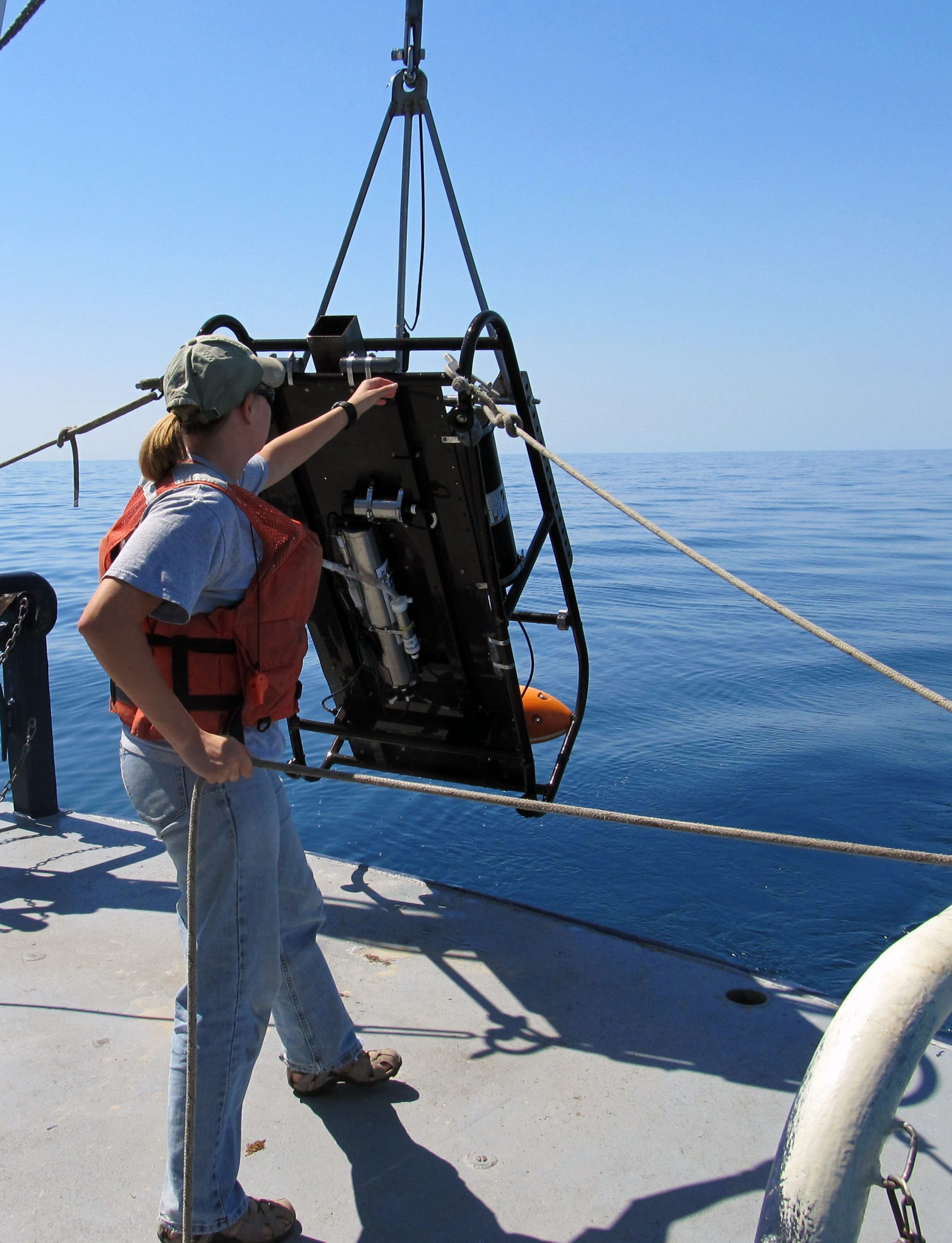 (Click to enlarge) Karen Dreger (USF) deploys a Shadow Image Particle Profiling Evaluation Recorder (SIPPER) off the stern of the R/V Bellows for zooplankton assessment. (Credit: Carl Taylor (USGS) |
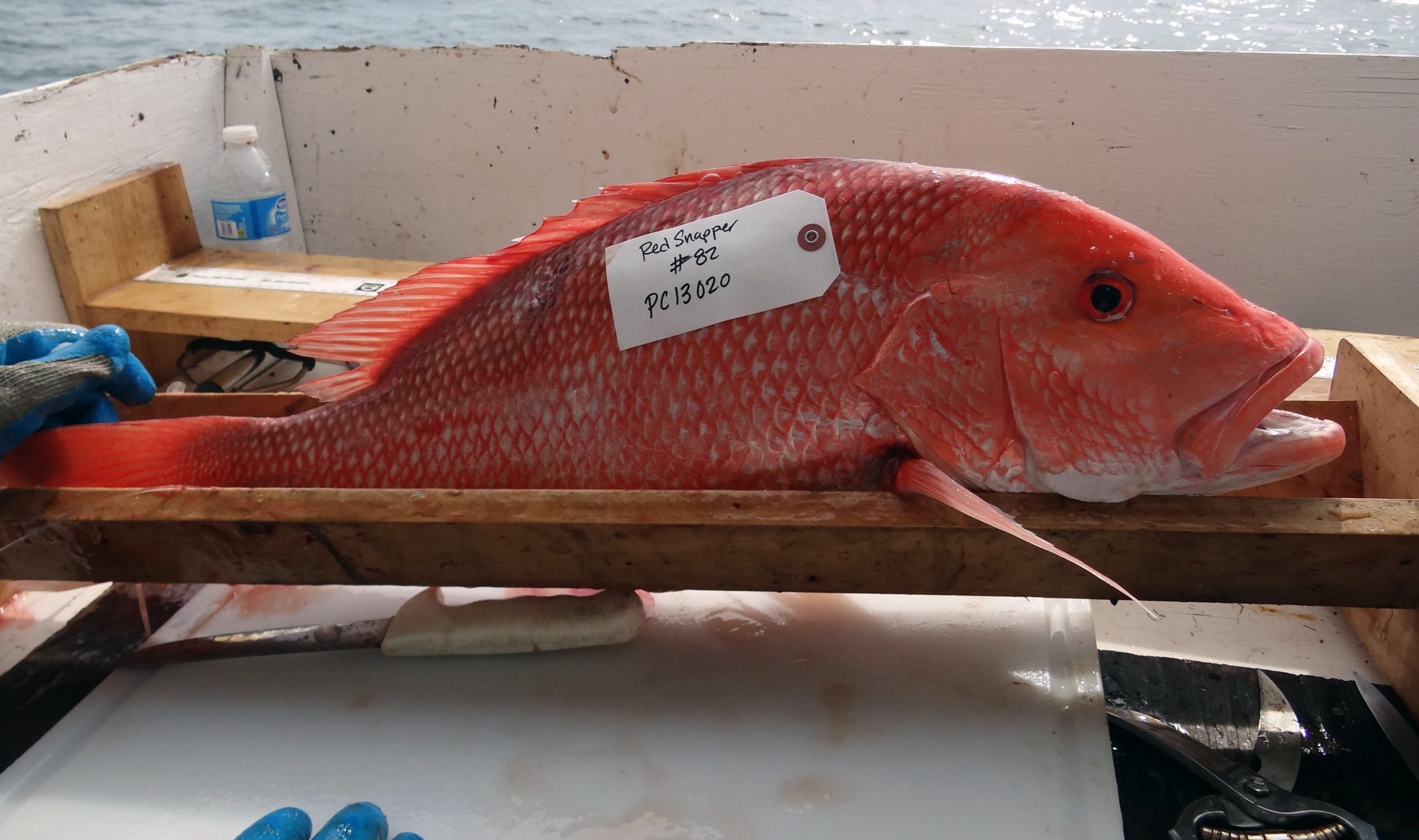 (Click to enlarge) Gulf Red Snapper tagged for fish health and community analysis studies. (Credit: S. Murawski) |
June 2012. In the days and months following the Deepwater Horizon oil spill, all eyes were fixed on images of where the oil was going and what it was impacting. Two years later, the focus has shifted to things unseen: Where is the oil now and what are the long-term consequences for marine ecology?
Funded by a Gulf of Mexico Research Initiative (GoMRI) award, the Consortium for the Integrated Modeling and Analysis of the Gulf Ecosystem (C-IMAGE) led by Dr. Steven Murawski at the University of South Florida (USF) has a sense of urgency as scientists take to the seas over the next three years seeking answers to these questions.
We are looking for the extended footprint of a diminishing signal as we get further from the spill event in 2010 – S. Murawski
Another focus of C-IMAGE leaders is the need to develop the next-generation of scientists to continue the research necessary to understand and protect the Gulf and its resources. Onboard every C-IMAGE cruise, post-doctoral fellows and
graduate students will work side-by-side with scientists, gaining experience in sampling and handling the challenges of field work in the deep sea. This hands-on research is also translated into student theses, dissertations, and publications.
Students’ lives will forever be changed by their participation in sampling that leads to better, more informed science about oil spill impacts. – S. Murawski
The C-IMAGE education and outreach team, led by Dr. Teresa Greely (USF), is coordinating a Teacher At Sea experience. Participating educators will assist with equipment deployment and sample retrieval and analysis, while gaining new knowledge and experiences they can bring back to their students.
The C-IMAGE collections of marine samples, imagery, and sounds will extend and expand upon the pre-spill and immediate post-spill collections. These time-series data will help scientists with the difficult task of identifying the effects on long-living organisms and habitats and separating the impacts of multiple stressors such as the oil spill, response efforts, natural conditions, and industrial activities. Through systematic long-term monitoring at sea and development of innovative analytical techniques, C-IMAGE scientists are going full steam ahead to sort out the impacts of this unprecedented pollution event.
Dis-entangling the impacts of the spill from natural oil seeps in the Gulf and chronic effects of oil exploration and production is a science mystery on the scale of a CSI. – S. Murawski
To understand how much of the released oil is buried in the sediments on the sea floor and its toxicity level, scientists are analyzing cores of deep sea sediments from areas near the spill site. Drs. David Hollander and Benjamin Flower (USF) and Drs. Gregg Brooks and David Hastings (Eckerd College) use a multi-core system that simultaneously collects twelve sediment cores to measure the amount, source, and chemistry of the oil found in these samples.
To understand the potential long-term impacts of oil on plankton populations and microbial communities, important parts of the marine food web, scientists are monitoring the De Soto Canyon and west Florida Shelf. Dr. Kendra Daly (USF) uses the SIPPER (Shadow Image Particle Profiling Evaluation Recorder) to measure zooplankton abundance and detect oil droplets.
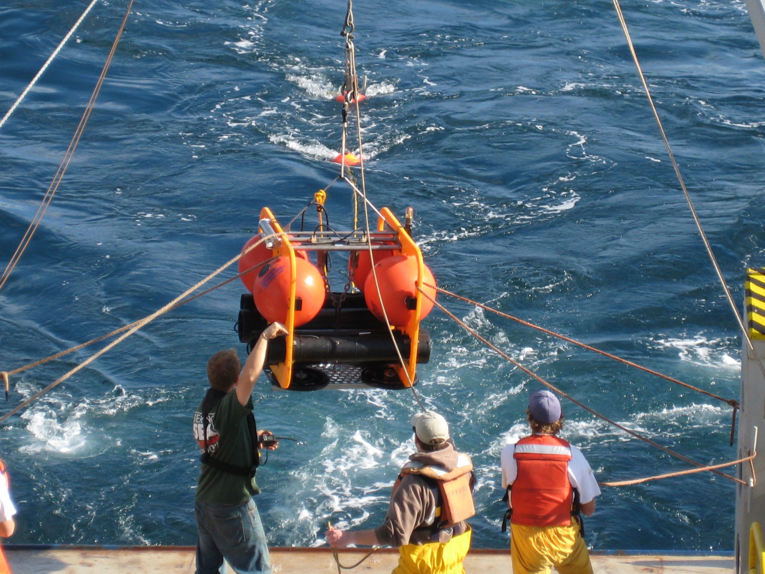
To understand the health of fishes and potential long-term sub-lethal impacts of oil and dispersants, scientists are monitoring reef fish communities and other select species in the Gulf. Dr. Will Patterson’s (University of South Alabama) research incorporates an ROV (Remotely Operated Vehicle) using video and CTD (Conductivity, Temperature, and Depth) measurements to monitor reef fish communities at natural and artificial sites south of Mississippi, Alabama, and Florida. Dr. Murawski uses specially-outfitted cables for bottom line surveys off the Louisiana coast to target specific fish species for tissue analyses. Dr. John Hildebrand (Scripps Institute of Oceanography) records underwater sounds with a HARP (High-frequency Acoustic Recording Package) to estimate the number of marine mammals potentially exposed to oil and population changes after the spill.
Research at sea requires specialized equipment and people experienced in vessel operations. To meet this need, C-IMAGE is coordinating much of their field work with the Florida Institute of Oceanography using the R/V Weatherbird II and the R/V Bellows.
C-IMAGE is comprised of sixteen research institutions spanning five U.S. states and three countries. These scientists are using a systems-level approach to understand the linkages of physical oceanography, chemistry, and biology to help them understand the ecological consequences of the oil spill. C-IMAGE’s field work at sea is a critical component in building the foundation for improved observational and predictive tools for future oil spills.
This research was made possible by a grant from BP/The Gulf of Mexico Research Initiative. The GoMRI is a 10-year, $500 million independent research program established by an agreement between BP and the Gulf of Mexico Alliance to study the effects of the Deepwater Horizon incident and the potential associated impact of this and similar incidents on the environment and public health.
© Copyright 2010- 2017 Gulf of Mexico Research Initiative (GoMRI) – All Rights Reserved. Redistribution is encouraged with acknowledgement to the Gulf of Mexico Research Initiative (GoMRI). Please credit images and/or videos as done in each article. Questions? Contact web-content editor Nilde “Maggie” Dannreuther, Northern Gulf Institute, Mississippi State University (maggied@ngi.msstate.edu).


