Study Uses ROV Imaging System to Measure Gas Bubble Size, Velocity, and Diffusion
– JULY 7, 2016
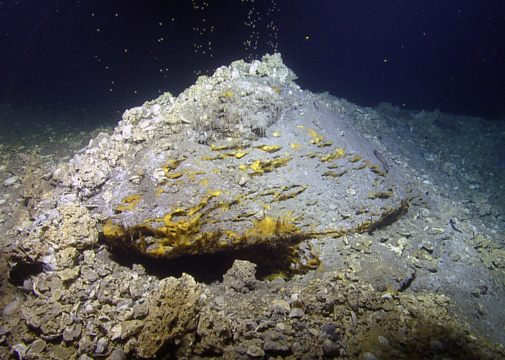 (Click to enlarge) Sleep Dragon seep site in the Gulf of Mexico. (Photo by Ocean Exploration Trust, Inc./GISR) |
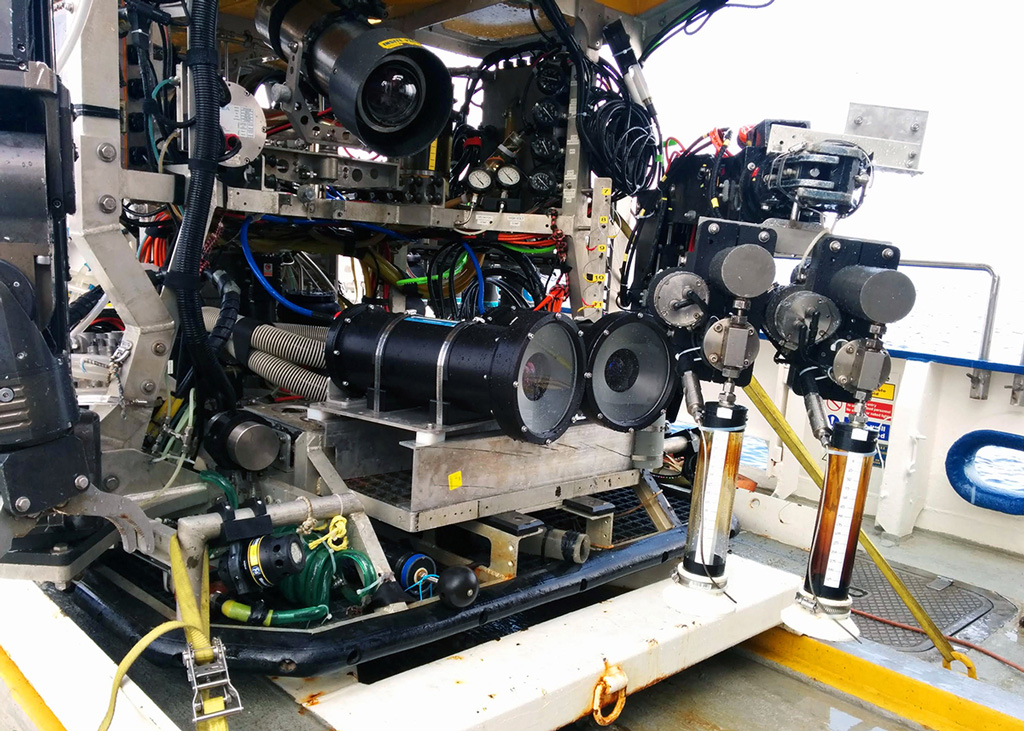 (Click to enlarge) The Texas A&M University stereo high-speed camera system. (Photo by Binbin Wang) |
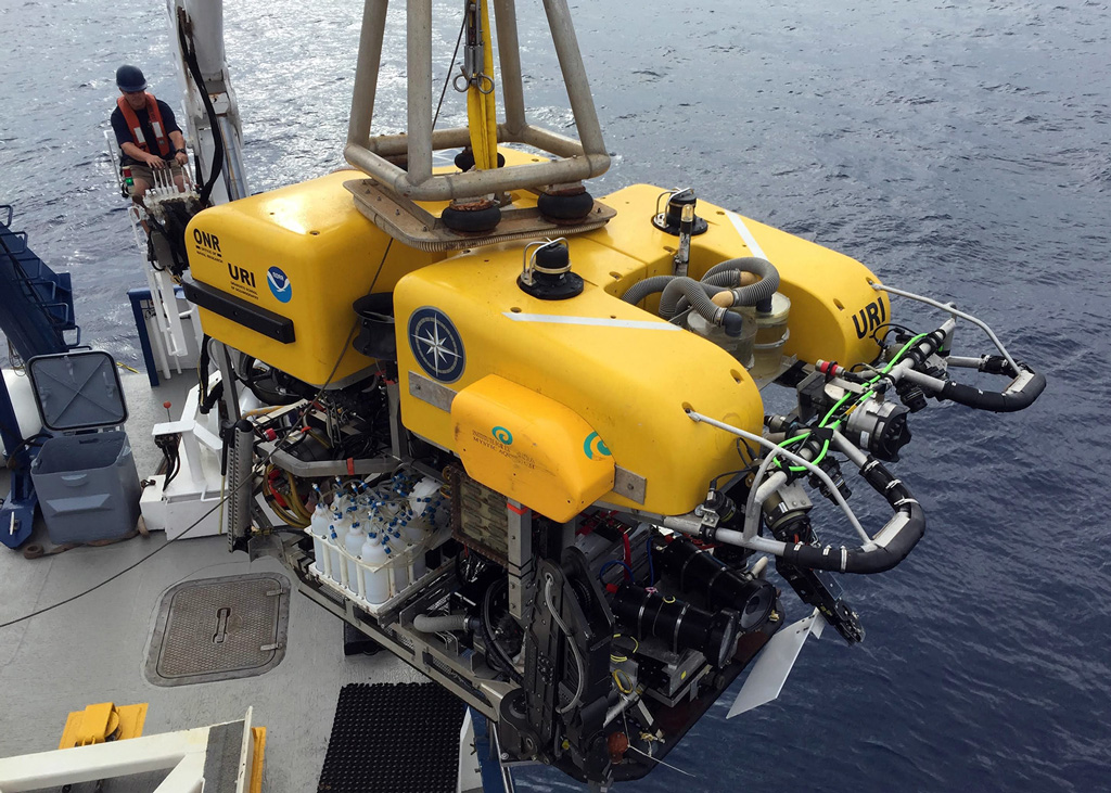 (Click to enlarge) he ROV Hercules used during the study. (Photo by Scott Socolofsky) |
Scientists used stereoscopic high-speed, high-resolution cameras mounted on remotely operated vehicles (ROVs) to make fine-scale imaging and chemistry measurements inside and around gas bubbles rising from two natural Gulf of Mexico seeps.
They found that median bubble sizes were 3 – 4.5 millimeters and that a clathrate hydrate shell formed around bubbles at 1.3 meters above the source in 1190 meters of water depth. They also observed that bubbles rose in two main patterns – zig-zag and spiral – and that bubbles with a zig-zag trajectory rose 40% more slowly than bubbles rising in a spiral trajectory. They published their findings in the Journal of Geophysical Research: Oceans: Observations of bubbles in natural seep flares at MC 118 and GC 600 using in situ quantitative imaging.
Spilled gas and oil compounds’ dissolution into the surrounding water column has an important impact on transport predictions and assessments of their toxicity and biological impacts. However, extreme deep-ocean conditions and a lack of in situ measurements have made it difficult for scientists to predict dissolution for deepwater blowouts such as Deepwater Horizon. Natural seeps are a viable surrogate for deep-sea plumes because both exhibit bubbles and droplets that are well-separated in water with low dissolved gas concentrations at nearly ambient temperature and pressure.
This study observed bubbles rising from two natural deep-sea seeps to better understand the mechanisms controlling the dissolution and transport of hydrocarbon bubbles in the ocean environment. The team studied the rising bubbles optically starting at the seafloor to an altitude of 200 meters. They assessed bubble behavior, such as breakup and coalescence, and quantitatively analyzed bubble characteristics including size distribution, rise velocity, total gas flux, and void fraction. Their measurements also captured mass transfer rates (the rates of methane’s dissolution out of the bubbles), providing insight into the extent that the observed hydrate shells impact dissolution rates.
This study was the first to use a high-resolution stereoscopic camera system’s high-speed capabilities to directly investigate deep ocean seeps. The system provided more accurate gas bubble size measurements and observations on whether the bubble-water interface was mobile (with rapid, wave-like deformations) or rigid (stiffened by ice-like methane hydrate skins). The researchers found that the bubble flare spreads out laterally due to a diffusion-like process and confirmed that bubbles rise largely independently, with little bubble-bubble or bubble-water interaction and negligible plume effect more than 1.5 meters above the source. These findings will help scientists predict the vertical flux of methane in the water column in future seeps or blowouts.
Co-author Scott Socolofsky explained that these findings will help first responders predict the flow rate of explosive gases during accidental oil well blowouts, “These observations allow us to build more accurate numerical models simulating the height of rise of natural deep-ocean seep flares and the vertical distribution of methane in the water column. Our findings are also important to oceanography and climatology, since we need to know if the large flux of methane gas bubbles from the seafloor around the globe will dissolve into the oceans or enter the atmosphere.”
The study’s authors are Binbin Wang, Scott A. Socolofsky, John A. Breier, and Jeffrey S. Seewald.
Data are publicly available through the Gulf of Mexico Research Initiative Information & Data Cooperative (GRIIDC) at https://data. gulfresearchinitiative.org (doi:10.7266/N7VM4969, doi:10.7266/N7QV3JGK, and doi:10.7266/N7N014GM).
Lead author Binbin Wang describes the study’s methods and findings about bubbles rising from natural gas seeps. (Video credit: American Geophysical Union)
************
This research was made possible in part by a grant from the Gulf of Mexico Research Initiative (GoMRI) to the Gulf of Mexico Integrated Spill Response Consortium (GISR) consortium.
The Gulf of Mexico Research Initiative (GoMRI) is a 10-year independent research program established to study the effect, and the potential associated impact, of hydrocarbon releases on the environment and public health, as well as to develop improved spill mitigation, oil detection, characterization and remediation technologies. An independent and academic 20-member Research Board makes the funding and research direction decisions to ensure the intellectual quality, effectiveness and academic independence of the GoMRI research. All research data, findings and publications will be made publicly available. The program was established through a $500 million financial commitment from BP. For more information, visit https://gulfresearchinitiative.org/.
© Copyright 2010- 2017 Gulf of Mexico Research Initiative (GoMRI) – All Rights Reserved. Redistribution is encouraged with acknowledgement to the Gulf of Mexico Research Initiative (GoMRI). Please credit images and/or videos as done in each article. Questions? Contact web-content editor Nilde “Maggie” Dannreuther, Northern Gulf Institute, Mississippi State University (maggied@ngi.msstate.edu).


