Fall 2018 – GoMRI Researcher Interview with Dr. Nick Shay
– JANUARY 8, 2019
(From Fall 2018 Newsletter) Dr. Lynn (Nick) Shay from the Rosenstiel School of Marine and Atmospheric Science at the University of Miami answered a few questions about his RFP-V project, Three-Dimensional Gulf Circulation and Biogeochemical Processes Unveiled by State-of-the-Art Profiling Float Technology and Data Assimilative Ocean Models, and his work as a co-principal investigator with the Deepsea to Coast Connectivity in the Eastern Gulf of Mexico (Deep-C) consortium.
1. Tell us a bit about your RFP-V research project, “Three-Dimensional Gulf Circulation and Biogeochemical Processes Unveiled by State-of-the-Art Profiling Float Technology and Data Assimilative Ocean Models.” What are the goals of your project?
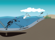
The goal of the project is to build an end-to-end product using profiling floats and an assimilative physical/biochemical model that could be used in the event of another subsurface spill in the Gulf of Mexico. A significant fraction of the effort has been the development and deployment of the technology where the floats measure the temperature, salinity and current as well as dissolved oxygen, chlorophyll, backscatter and colored dissolved organic matter (CDOM) to as deep as 2000 meters (m). Of particular importance to the project is that the float measures current and shear quite well owing to the electromagnetic subsystems that were designed by engineers at the University of Washington’s Applied Physics Laboratory and integrated into the Autonomous Profiling Explorer (APEX) floats at Teledyne-Webb.
2. You were also a co-principal investigator with the RFP-I-funded consortium Deepsea to Coast Connectivity in the Eastern Gulf of Mexico (Deep-C). Could you tell us a bit about your involvement with this consortium?
Our involvement focused on tropical storms/hurricanes moving over the northern Gulf region close to the area of the BP oil spill and the DeSoto Canyon. In this case we extensively sampled the ocean using profilers deployed from the NOAA WP-3D aircraft to acquire temperature, salinity and currents prior, during and subsequent to Hurricane Isaac in 2012. These profilers went as deep as 1500 m (4500 feet) beneath the surface. In addition, we deployed several atmospheric sondes to measure the temperature, humidity and wind fields of Isaac.
3. What is your background and how did you get involved with this kind of work?
My background is in physical oceanography and fluid dynamics. As a graduate student (too many years ago), I worked in the Department of Meteorology while obtaining my degree in the Department of Oceanography at the US Naval Postgraduate School. There are clearly linkages between the two fluids that are amplified across the air-sea interface over a broad spectrum of time and space scales.
4. What are some of the most significant or exciting findings so far in your GoMRI-funded research?
It is one of first long-term deployments of the Autonomous Profiling Explorer floats with electromagnetic subsystems (APEX-EM) spanning about 18 months. The simultaneous measurement of the physical and biochemical properties using this new technology has allowed us to assess the oceanic responses to the passage of cold atmospheric fronts and hurricanes over the northern Gulf. For example, we could change missions of the floats using Iridium remote sensing allowing the float to sample faster over a smaller depth range (as we did in Hurricane Michael) or sampling slower in time to depth. The team observed significant changes in the dissolved oxygen and chlorophyll concentrations just beneath the depth of the surface mixed layer during frontal passage as well as during Hurricane Nate (2017). Our team believes this will be a game changer given the strong ocean currents and shears that primarily drive mixing events are linked to the changes in the biochemical concentrations. In addition to providing long time/ space series of current and shear, the Lagrangian floats are uniquely capable of sensing deep ocean properties of the Loop Current and the shedding of warm eddies, which has relevance to the Loop Current study sponsored by the National Academies of Sciences, Engineering, and Medicine. Finally, the coupled physical/biochemical model is showing promise in assimilating these data as we move towards that end-to-end product as noted above.
5. Can you talk a bit more about the assimilative model and how it can be used by responders in the event of future oil spills?
Having an evaluated end-to-end model with data assimilation will allow responders to target specific areas in the Gulf to aid in mitigating the possible effects of another subsurface spill. The assimilation scheme will be able to ingest various data types (physical, biochemical) to predict where the oil (or hydrocarbons) are heading. Recall the subsurface spill in 2010 from the well head had various layers or “clouds” of hydrocarbons in the water column that were being moved around by the subsurface ocean currents as well as surface signatures sensed by satellite missions.
6. If funding were not an issue, what would you add to your GoMRI-funded project?
Given the oceanographic linkages between the Caribbean Sea and the Gulf of Mexico via the Yucatan Straits and the fact that the region is known as “Hurricane Alley,” I would deploy more of these floats to map the shallow and deep water pathways associated with the background circulation and estimate upper ocean heat content relative to 26oC (78oF) water to assess the variability in the biochemical properties starting in the eastern part of the Caribbean Sea basin. It is well established that storms moving over this large basin often intensify to severe hurricane status and can make their way into the Gulf. In this context, profiling floats offer a relatively inexpensive way to cover a large part of the basin. Such long-term measurements are critical for coupled forecast models to accurately predict intensity and structure change of hurricanes which affect our hemisphere (e.g., Hurricane Michael). These measurements would be invaluable to map out the current field to depth in these basins.