Study Reviews Forecast System Used During Deepwater Horizon
– July 30, 2015
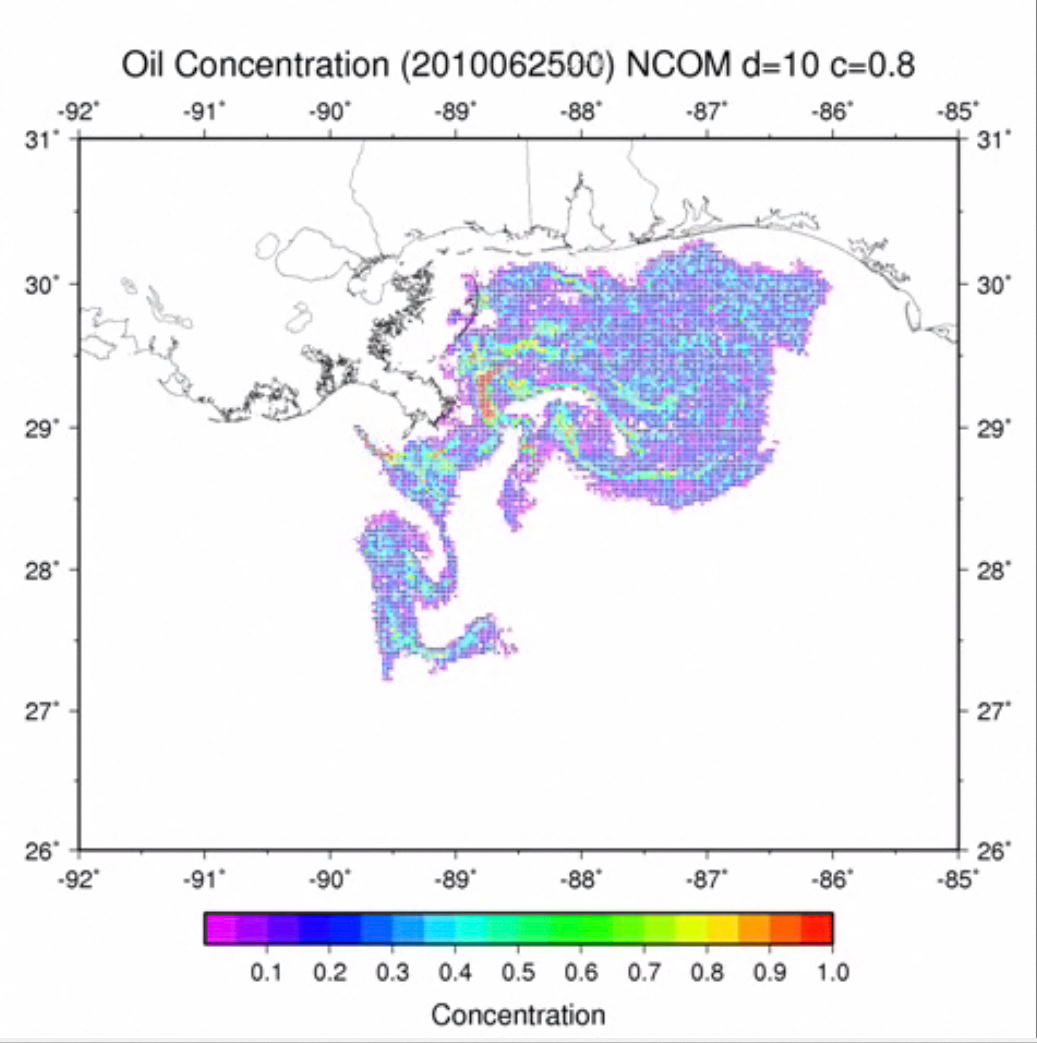 (Click to enlarge) Researchers simulated the oil spill from June 10 to July 10, 2010 in 5-day increments. The objective was to understand the factors causing the inshore incursion of oil into the western Mississippi Sound in late June. (Provided by Pat Fitzpatrick) |
A team of university, NOAA, Naval Research Lab (NRL), and Naval Oceanographic Office researchers reviewed four evaluations of the ocean forecast system American Seas (AMSEAS) which was used during the 2010 spill to simulate oil trajectory.
They found that AMSEAS showed a small but systematic improvement compared to other NRL systems and reasonably represented ocean conditions during the Deepwater Horizon spill. Based on these positive validation studies, the authors conducted a spill simulation using archived forecasts that reproduced oil transport in the Gulf and into estuaries east of the Mississippi River. The researchers published their findings in the January 2015 issue of Frontiers in Earth Science: Initial evaluations of a Gulf of Mexico/Caribbean ocean forecast system in the context of the Deepwater Horizon disaster.
Four organizations evaluated the AMSEAS system. The Naval Oceanographic Office evaluated the accuracy of AMSEAS as part of its formal operational testing. A university consortium evaluated the system for use in their Integrated Ocean Observing System (IOOS) coastal modeling testbed. These groups focused on immediate and short term forecasts of temperature and salinity over the continental shelf and deeper Gulf waters. The IOOS analysis also evaluated surface wind forecasts. A petroleum industry consortium evaluated AMSEAS as part of their Gulf of Mexico 3-D Operational Ocean Forecast System Pilot Prediction Project (GOMEX-PPP), with emphasis on Loop Current forecasts and associated eddies. The Northern Gulf Institute evaluated AMSEAS hindcasts for oil spill dispersal that incorporated data from a Lagrangian particle tracker.
This study’s research team used operationally-relevant tolerance metrics for water temperature, salinity, wind, sea surface height, and volume transport. While there were some temperature biases and wind speed errors, the validation metrics indicated that AMSEAS could be used as a standard to measure existing and future forecast capabilities in the Gulf of Mexico. The team recommended advances in long-term observational networks, data assimilation, and increased model resolution to improve forecasting accuracy.
Regarding the authors’ spill simulation using archived ocean currents, Mississippi State scientist Pat Fitzpatrick explained, “The simulation identified that Hurricane Alex and a non-tropical cyclone off the Louisiana coast were the main influences for pushing oil into the western Mississippi Sound through a pass known as the Rigolets, illustrating the importance of atmospheric influences on oil spill transport.”
As operational ocean-prediction capabilities have become more accurate, demand has grown for immediate forecasts to support ocean operations and resource-management activities. Search-and-rescue operations, offshore oil platform management, oil spill mitigation, marine weather forecasting, fisheries management, and adaptive observing-system deployments also benefit from accurate forecasting. The researchers noted that although more than ten Gulf of Mexico circulation models exist, very little literature compares their efficacy or accuracy. They suggested that systematic comparisons and reviews of Gulf forecasting systems would advance operational ocean predictions and improve functionality.
This animation (above) shows a pulsing action due to the diurnal tides common in this region. By the end of June, there is a sudden shift of oil into western Mississippi Sound and Lake Borgne. A brief retreat occurs afterwards followed by a more prolonged inward penetration to these same subregions. Provided by Pat Fitzpatrick.
The study’s authors are Edward D. Zaron, Patrick J. Fitzpatrick, Scott L. Cross, John M. Harding, Frank L. Bub, Jerry D. Wiggert, Dong S. Ko, Yee Lau, Katharine Woodard, and Christopher N. K. Mooers.
An open access to this publication that includes a technical report is available here.
************
This research was made possible in part by a grant from the Gulf of Mexico Research Initiative (GoMRI) to the Northern Gulf Institute. Other funding sources included the National Oceanic and Atmospheric Administration (Grant 2010-012), the U.S. Department of Homeland Security (Award #2008-ST-061-ND 0001), and by the Department of Energy Research Partnership to Secure Energy for America Project (#08121-2801).
The GoMRI is a 10-year independent research program established to study the effect, and the potential associated impact, of hydrocarbon releases on the environment and public health, as well as to develop improved spill mitigation, oil detection, characterization, and remediation technologies. An independent and academic 20-member Research Board makes the funding and research direction decisions to ensure the intellectual quality, effectiveness and academic independence of the GoMRI research. All research data, findings and publications will be made publicly available. The program was established through a $500 million financial commitment from BP. For more information, visit https://gulfresearchinitiative.org/.
© Copyright 2010- 2017 Gulf of Mexico Research Initiative (GoMRI) – All Rights Reserved. Redistribution is encouraged with acknowledgement to the Gulf of Mexico Research Initiative (GoMRI). Please credit images and/or videos as done in each article. Questions? Contact web-content editor Nilde “Maggie” Dannreuther, Northern Gulf Institute, Mississippi State University (maggied@ngi.msstate.edu).


