Science at Sea: SPLASH Experiment Improves Predictions for Oil Moving toward Shore
– AUGUST 10, 2017
 View from the RV Walton Smith where the ocean and freshwater from the Mississippi River meet. Photo by Tamay Ozgokmen. |
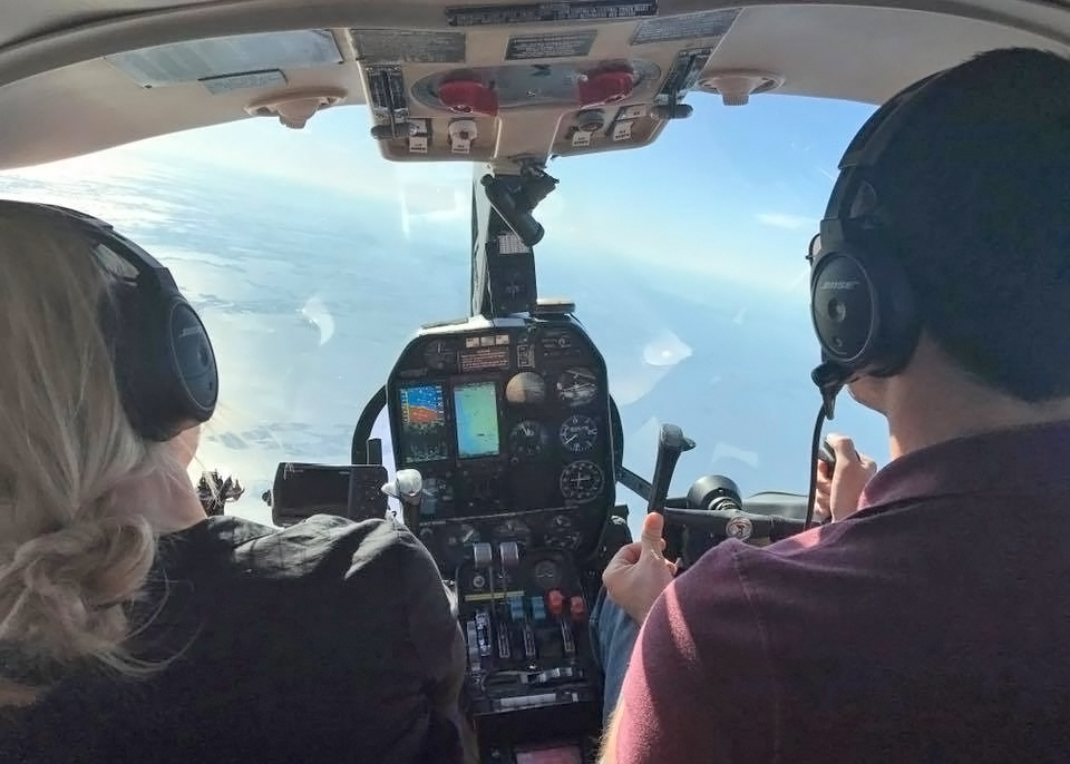 The aerial observation team from the University of Brest, France measure sea surface temperature and surface roughness and take visual images of fronts. Their observations assist the ground teams to select exact locations for drifter deployments. Photo provided by CARHTE. |
 Guillaume Novelli (L) releases a Phatom 4 pro drone from the RV Walton Smith while Cedric Guigand (R) operates the flight controls. High-resolution cameras on the drone collected aerial observations of floating bamboo drift plates and fast-evolving fronts at scales of 1 meter – 200 meters. Photo by Tamay Ozgokmen. |
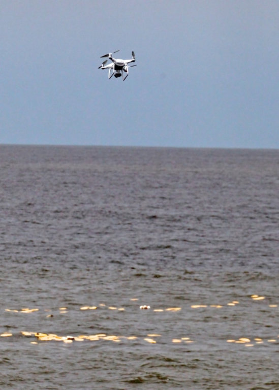 A Phantom 4 pro drone collects aerial observations of floating drift plates from 100 meters. Photo by Tamay Ozgokmen. |
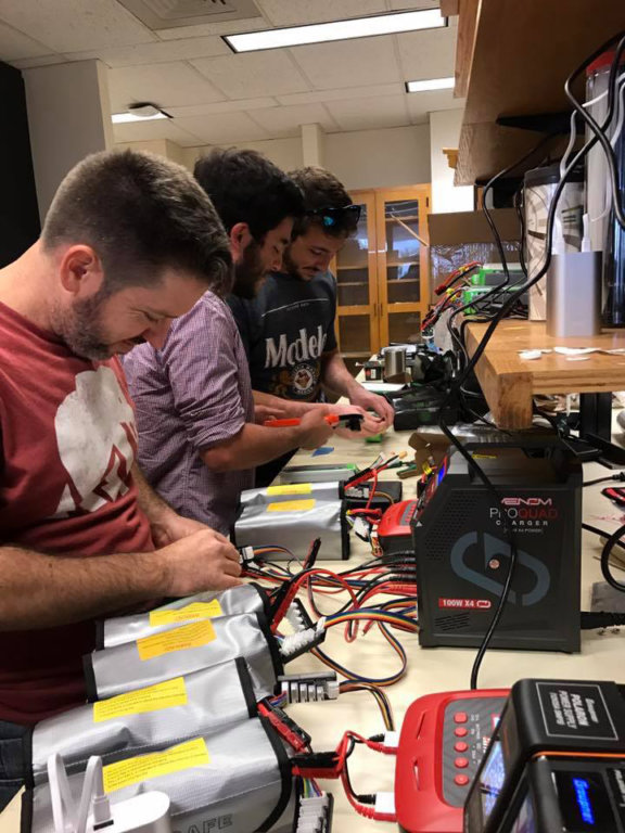 The drone team prepares batteries as many back ups are needed to reload and relaunch drones for continuous imagery of drift card distribution. Photo provided by CARTHE |
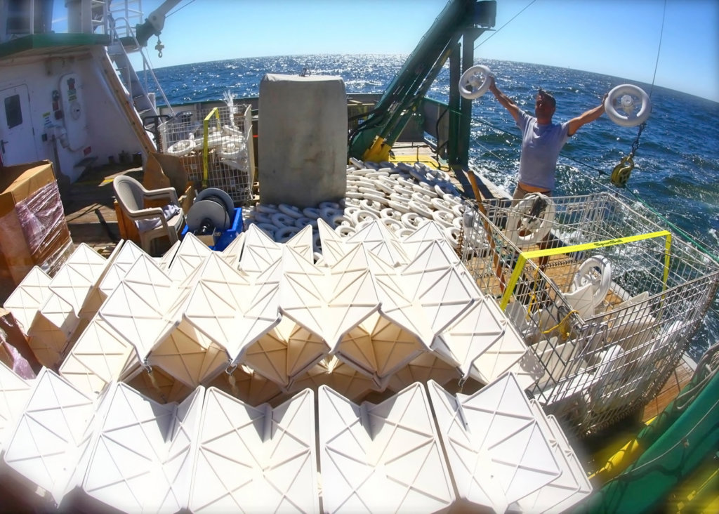 Drifters on the deck of the RV Walton smith are ready for transfer to small boat teams for targeted deployment. Photo by Tamay Ozgokmen. |
Response decisions during Deepwater Horizon relied on forecasts of where the oil was going and when it would get there. Researchers with the CARTHE consortium have been working to improve the information that goes into making ocean transport forecasts. The group recently completed the last of four field experiments that link the dynamics of deep ocean, shelf, and coastal surface currents, where materials such as oil or debris naturally accumulate, in a way that has never been done before.
Led by chief scientist Jeroen Molemaker, CARTHE conducted a month-long (mid-April to mid-May) experiment named SPLASH (the Submesoscale Processes and Lagrangian Analysis on the Shelf) that involved hundreds of pieces of equipment and nearly as many people. SPLASH took place south of Grand Isle, Louisiana, across the shelf and shelf break, and along bays and inlets west of the Mississippi River Delta. This area has freshwater influx and complex small-scale processes, which heavily influenced where oil did and did not go during the 2010 spill, that are not well understood or represented in forecast models. This is about to change for the better.
The team used 550 custom-made, biodegradable, GPS-equipped drifters; 5,000 drift cards; 5 drones; 6 small boats; 2 planes; 1 research vessel; and a suite of instruments that measured physical properties and conditions of water and the atmosphere. The resulting data includes a first-time measurement of currents at 1 centimeter to 1 meter depth across the Louisiana shelf and near-shore waters. The team also gathered data that shows the significant influence of fresh water outflows on near-surface currents.
Getting the Big Picture
The CARTHE team demonstrated the importance of observing surface currents for transport predictions during the Grand LAgrangian Deployment or GLAD near the Deepwater Horizon site. Their second large drifter deployment, the LAgrangian Submesoscale ExpeRiment or LASER, measured the processes driving the initial quick burst and longer-term dispersion observed during GLAD. The team collected data on currents between the inner shelf and Destin beach, Florida during their Surfzone Coastal Oil Pathways Experiment or SCOPE. CARTHE completed the picture with their SPLASH experiment that bridged the processes that drive surface currents from the deep ocean, across the shelf, and toward shore. The four experiments, done at different times of the year, also provided better understanding about seasonal variability and its influence on water transport.
The SPLASH Experiment
Team leads, guided by real-time assimilative models from the U.S. Naval Research Laboratory, made decisions for drifter and drift card deployments as fronts, circulations, and weather evolved. Deployment decisions set in motion groups who measured atmospheric and hydrographic conditions, flew planes and drones for aerial observations, coordinated vessel and small boat operations, and recovered drifters afterwards.
SPLASH used several deployment strategies, alternating the release of many and a few drifters close together and further apart, to observe broad features and then use finer sampling to capture areas of interest as they evolved. Small boat teams left the Grand Isle harbor before sunrise each morning and met up with the RV Walton Smith to pick up drifters. Using aerial observations from the day before, each boat team traveled to different fronts and circular water currents (eddies) and quickly deployed drifters to capture these fast-evolving features, a critical aspect of this endeavor. Afterward, they measured water properties while slowly following the drifters and the front or eddy. An acoustic Doppler profiler took velocity measurements of currents below the boats.
Aerial observation teams helped identify targeted deployment locations. One team operated a Partanavia P86 plane that measured sea surface temperature, water surface roughness, and color (for fronts) and took position and time measurements for analysis later. Another team flew the NASA Jet Propulaion Laboratory’s King Air B200 plane that had a DopplerScat, a new radar that measures both wind and ocean currents from multiple directions at once across a broad area. The SPLASH experiment provided NASA an opportunity for the first large-scale validation of the DopplerScat.
Shipboard acquisition systems included sensors for wind velocity, wave characteristics, current profiles, and physical properties of water. One instrument they used was a Towed Instrument Array that took measurements every 20 or 30 centimeters, which is important when measuring fronts with horizontal scales of a couple meters. Another key technology, an X-band marine radar and polarimetric cameras, made it possible for the team to see fronts in real time. Researchers will use the atmospheric and hydrographic data later to provide context and help explain results.
SPLASH drew on the successes and lessons learned from CARTHE’s three previous experiments as they dealt with difficulties such as storms and equipment failures. Molemaker credits the success of SPLASH to the team’s hard work and positive attitude. “An experiment like this, which involved so many facets and people from around the country and beyond, can only succeed if each and every one takes the responsibility for his or her own tasks. Everyone, including people completely new to ocean observations, rose to the occasion and performed above expectations. I was particularly impressed by the willingness to help others where needed, no matter the time of day or night.”
Something Extra
An opportunity arose for collaboration with oceanographer Villy Kourafalou who is studying the influence of Mississippi River-induced fronts on oil transport. Members of the CARTHE SPLASH team and the Kourafalou team collected data around the Taylor oil platform, which has been leaking since Hurricane Ivan in 2004, south of the Mississippi River delta. The teams used satellites, drones, surface current drifters, floating drift plates, ship-based instruments, and radar around the leaking platform and a nearby river-plume front. They tracked the rapid changes of spreading surface oil in tandem with the front and measured oil thickness, providing data that will help improve future oil transport monitoring and predictions.
Preliminary Insights
Tamay Ozgokmen, CARTHE’s Principal Investigator, described a few initial observations, “Freshwater fronts acted like a natural boom, and they collected everything, including a large dead alligator! The fronts were extremely narrow, typically a few feet wide, with multiple fronts one after another and different wave motion across them.” Data that reflects the influence of fresh water outflows on near-surface currents will help improve transport predictions.
The SPLASH experiment also helped answer a fundamental question about surface currents. “Almost all [spilled/leaking] oil collects near the surface, mainly in the upper 1 cm, but nobody knew what the currents are there,” explained Ozgokmen. “The atmosphere is typically 10 to 100 [times] faster than the ocean, but 1000 [times] less dense, so one of the leading questions is what is the “surface current” in the ocean, given such huge changes on either side. Using many observing platforms, we have an answer to that for the first time.”
What’s Next
Scientists will use the tens of millions of data points from GLAD, SCOPE, LASER, and SPLASH to construct a more complete picture of transport pathways and physical processes across the Gulf of Mexico and improve retrospective spill analyses and future transport predictions. The four CARTHE experiments have far-reaching applications with new scientific insights that can inform navigation, energy production, climate science, hurricane predictions, search and rescue, beach safety, and tracking floating non-biodegradable plastics pollution, which is a rapidly growing ocean problem.
As the team enters a dedicated phase of analyzing data and publishing the science, they are also focusing on graduate student dissertations. “We invested in the next generation of scientists who got to participate in these large “ocean games,” said Ozgokmen, “I believe that the investment will pay off!”
Technology Used During SPLASH
Take a look at the technology that CARTHE researchers use to answer, Where is water going to go in the ocean? Video credit: Waterlust.
The CARTHE group includes 83 researchers and staff representing 26 institutions: Brown University, Consiglio Nazionale delle Riceche, Delft University of Technology, Drexel University, Duke University, Florida International University, Florida State University, Georgia Institute of Technology, Massachusetts Institute of Technology , Naval Postgraduate School, Naval Research Laboratory at Stennis Space Center, New Jersey Institute of Technology, North Carolina State University, Nova Southeastern University, Texas A&M University-Corpus Christi, The City University of New York – College of Staten Island, The University of Texas at Austin, University of California Los Angeles, University of Cambridge, University of Delaware, University of Florida, University of Illinois at Urbana-Champaign, University of Miami, University of South Florida, University of Washington, and Yale University
 Team members on the RV Walton Smith distributed drifters to crews on agile, fast small boats during drifter deployment. Photo provided by CARTHE. |
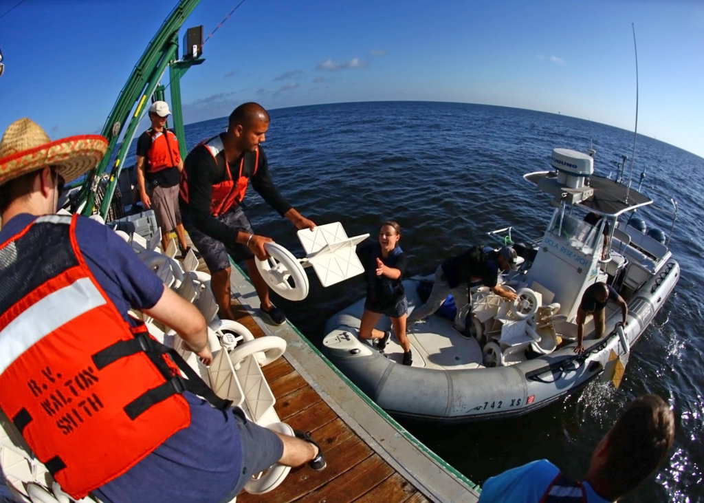 Crew aboard the RV Walton Smith transfers drifters to the team on the “Zodiak,” a 28’ boat that can travel 34 knots. It has instruments typically found only on larger oceanographic vessels that measure small, short-lived dynamic ocean features such as water properties around a freshwater front. Photo by Tamay Ozgokmen. |
 The small boat and RV Walton Smith teams devised an efficient meant to transfer drifters to one another by stringing several drifters together. Photo by Tamay Ozgokmen. |
 The drone photographed the torpedo-shaped AUV Remote Environmental Monitoring Unit as it moved toward the bamboo drift plates and collected data on upper-ocean currents and water chemistry just beneath the plates. Photo provided by CARTHE. |
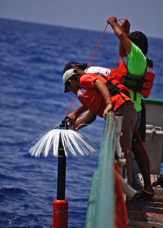 Team members deploy a microstructure device that measures fine-scale turbulence and dissipation at depth. Photo by Tamay Ozgokmen. |
************
This research was made possible by a grant from the Gulf of Mexico Research Initiative (GoMRI) to the Consortium for Advanced Research on Transport of Hydrocarbon in the Environment II (CARTHE II).
The Gulf of Mexico Research Initiative (GoMRI) is a 10-year independent research program established to study the effect, and the potential associated impact, of hydrocarbon releases on the environment and public health, as well as to develop improved spill mitigation, oil detection, characterization and remediation technologies. An independent and academic 20-member Research Board makes the funding and research direction decisions to ensure the intellectual quality, effectiveness and academic independence of the GoMRI research. All research data, findings and publications will be made publicly available. The program was established through a $500 million financial commitment from BP. For more information, visit https://gulfresearchinitiative.org/.
© Copyright 2010-2017 Gulf of Mexico Research Initiative (GoMRI) – All Rights Reserved. Redistribution is encouraged with acknowledgement to the Gulf of Mexico Research Initiative (GoMRI). Please credit images and/or videos as done in each article. Questions? Contact web-content editor Nilde “Maggie” Dannreuther, Northern Gulf Institute, Mississippi State University (maggied@ngi.msstate.edu).


